Boulder Basin
14 mi northeast · USDA Forest Service
Black Mountain Road is is poor condition at this time. A four-wheel drive (4WD) vehicle is recommended with a minimum ground clearance of 6 inches. Drive at your own risk.
Outdoors
Campgrounds and camping areas near Hemet on federal land, with which ones take reservations on Recreation.gov.
Good to know: Popular campgrounds book up months ahead on Recreation.gov; first-come sites fill early on weekends and holidays.
14 mi northeast · USDA Forest Service
Black Mountain Road is is poor condition at this time. A four-wheel drive (4WD) vehicle is recommended with a minimum ground clearance of 6 inches. Drive at your own risk.
14 mi east · USDA Forest Service
The picturesque Fern Basin Campground is a perfect escape from a busy lifestyle. It provides peace and quiet in the mountains of southern California as well as access to countless recreational opportunities.
14 mi east · USDA Forest Service
The Marion Mountain Campground offers a beautiful retreat in the San Bernardino National Forest. It provides access to a number of hiking trails that lead to some of the most spectacular views of Southern California.
Map of 29 places loads as you scroll.
Black Mountain Road is is poor condition at this time. A four-wheel drive (4WD) vehicle is recommended with a minimum ground clearance of 6 inches. Drive at your own risk.
The picturesque Fern Basin Campground is a perfect escape from a busy lifestyle. It provides peace and quiet in the mountains of southern California as well as access to countless recreational opportunities.
The Marion Mountain Campground offers a beautiful retreat in the San Bernardino National Forest. It provides access to a number of hiking trails that lead to some of the most spectacular views of Southern California.
Black Mountain Road is is poor condition at this time. 4 Wheel Drive is recommended. The road is currently a high-priority for maintenance, which should be occuring in June, 2023.
Dripping Springs campground is a wonderful campground adjacent to the Agua Tibia Wilderness. Recreation Recreation in the area includes hiking, trail running, and backpacking.
The Beauty Mountain Wilderness encompasses a total of 15,627 acres and is managed by the BLM's Palm Springs-South Coast Field Office .
Located on the Cleveland National Forest, Oak Grove Campground is nestled in a valley of large oak groves and manzanita. Recreation Oak Grove Trail is a short walk of 1.5 miles and is located across Rt. 79, behind the Ranger Station.
Fry Creek Campground is situated in the heart of Cleveland National Forest, uniquely located down the road from the world-famous Palomar Observatory.
Falcon Group Campground has three individual group campsites just off the scenic Ortega Highway in Southern California, which connects San Juan Capistrano and Temecula Valley Highway.
Science buffs and families are drawn to Observatory Campground for its proximity to the Palomar Observatory, a world-class center of astronomy research operated by the California Institute of Technology.
This wilderness is part of the eastern slope of the San Bernardino Mountains with topography rapidly changing from low, rolling foothills and canyons to steep, rugged mountains. Elevations range from 2,300 to 5,500 feet.
The Coon Creek Group Campground is located in the pine-covered mountains of Southern California. The unique campground is home to three historic cabins and a stunning view into the Coachella Valley on clear days.
The Council Group Campground is a great place to enjoy a large outdoor gathering with just about everything the San Bernardino National Forest has to offer.
The Heart Bar Campground provides access to some of southern California's greatest backcountry hiking, biking and horseback riding trails, as well as a nice play to experience nature.
The Lobo Group Campground is nestled in the beautiful Barton Flats area of the San Bernardino Mountains. It is surrounded by picturesque pine trees, providing ample shade and miles of scenic landscapes.
The San Gorgonio Campground provides access to a variety of recreational opportunities, as well as a beautiful location in which to enjoy nature.
Remember your OUTDOOR ETHICS when enjoying your public lands. Please RECREATE RESPONSIBLY.
The Skyline Group Campground is a great place to enjoy an extended family or large group camping experience. It is close to a variety of wilderness trails and offers abundant fishing opportunities within the surrounding mountain creeks.
This San Bernardino County Parks managed area is an oasis within one of the fastest growing areas of Southern California. Riverside County and the City of Corona also provide recreation facilities.
Surronded by the stark beauty of the Santa Rosa Mountains, Lake Cahuilla (pronounced Kah-wee-ah) is a favorite recreation area in the Coachella Valley.
The north-central portion of this Wilderness area holds the rugged Bighorn Mountains and the eastern foothills of the San Bernardino Mountains.
Juniper Flats covers 101,272 acres of mixed public and private lands. Located between the Mojave Desert and the forests of the San Bernardino Mountains, Juniper Flats hosts a unique mixture of plants from both environments.
The terrain within the Santa Rosa Mountains Wilderness is rugged with elevations rising dramatically from just above sea level to 7,000 feet.
Click here for the latest information concerning upcoming military training and closures of the Shared Use Area. Overview Johnson Valley is a varied landscape for the off-highway vehicle driver.
The Mecca Hills Wilderness now contains a total of 26,242 acres and is managed by the BLM's Palm Springs-South Coast Field Office . All of the Wilderness is in the state of California.
The Ord Mountain Route Network is south of Barstow and links the Stoddard Valley and Johnson Valley Off-Highway Vehicle Areas, also known as Open Areas. Travel within the network is limited to posted open routes.
The western boundary of the Orocopia Mountains Wilderness is contiguous with the Mecca Hills Wilderness with the exception of the Meccacopia Jeep Trail, which bisects the two wilderness areas.
The Sawtooth Mountains Wilderness now contains a total of 33,610 acres and is managed by the Bureau of Land Management. All of the Wilderness is in the state of California.
Distances are straight-line miles from downtown Hemet. Listings come from Recreation.gov’s federal recreation database; check each official page for hours, fees, fire restrictions and closures before you go.

THINGS TO DO · YOUTUBE SHORT
A local activity Short shared by Onlyintheie.
Watch on YouTube ↗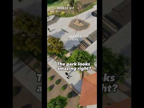
THINGS TO DO · YOUTUBE SHORT
A local activity Short shared by Noobdudebro.
Watch on YouTube ↗


Boulder Basin (USDA Forest Service), about 14 miles northeast of Hemet as the crow flies. Next are Fern Basin (14 mi) and Marion Mountain (14 mi).
Based on Hemet’s average highs, October–May. Conditions at higher elevations can be much cooler.
15 of the 29 places listed here take reservations on Recreation.gov; others are first come, first served.
Federal agencies including USDA Forest Service, Bureau of Land Management, US Army Corps of Engineers. Each listing links to its official page for hours, fees, closures and current conditions.